
In twelfth-century Palermo, an Arab geographer from Ceuta assembled the testimonies of sailors, merchants and travellers from three continents to produce the most accurate world map of the Middle Ages.
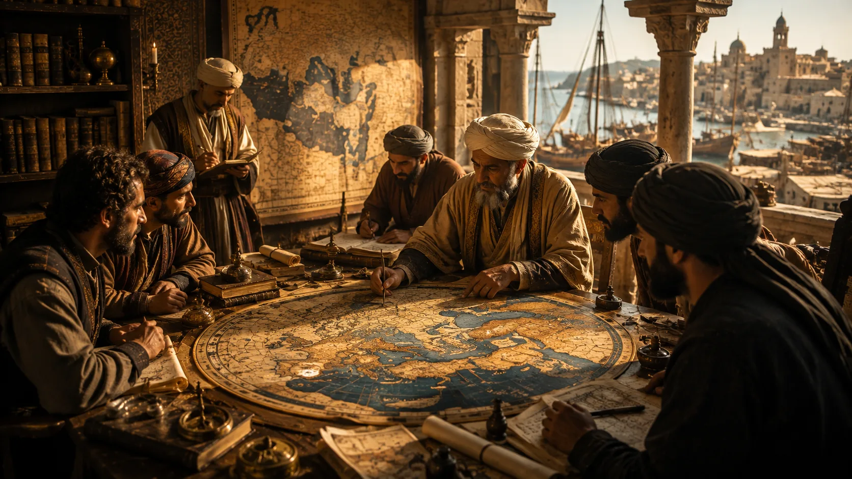
In 1154, Muhammad al-Idrisi completed the Tabula Rogeriana at the court of Roger II of Sicily — a world map so precise and ambitious that no cartographic work surpassed it for nearly three centuries. This is the story of the Arab geographer from Ceuta who connected Islam, Europe and Africa on a single silver disc.
A Court at the Edge of Two Worlds
Sicily in the twelfth century occupied a position unlike almost anywhere else on the medieval map. It was not simply an island in the centre of the Mediterranean. It was a crossroads — a place where the languages of the Quran, the Gospels and the Orthodox liturgy were heard simultaneously in the same city, sometimes in the same street. Palermo, its capital, contained mosques that had been converted to churches and churches that had been built to resemble mosques. The royal palace glittered with Byzantine mosaics executed by craftsmen who worked alongside Arab architects. Arabic was still spoken in the markets; Greek was used in royal chanceries; Norman French was the language of conquest, though its speakers were already learning to blend into something richer and stranger than any of its constituent parts.
This was not accidental. It was the deliberate creation of one man.
The Man Behind the Map: Who Was Al-Idrisi?
Born in Ceuta, Educated in Córdoba
Abu Abdullah Muhammad al-Idrisi al-Qurtubi al-Hasani as-Sabti was born in 1100 in Ceuta — then known as Sabtah — a port city pressed between the Atlantic and the Mediterranean at the northernmost tip of Morocco, visible from the shores of Andalusia on a clear day. His full name carries within it a compressed biography: al-Qurtubi connects him to Córdoba, where he studied; al-Hasani signals his descent from Hasan ibn Ali and, through him, from the Prophet Muhammad; as-Sabti anchors him to Ceuta, the city of his birth.
He came from the Hammudid dynasty of North Africa and Al-Andalus — a lineage of princes and scholars who had ruled Málaga until political misfortune pushed his great-grandfather across the strait into Morocco. There was, in other words, something of the displaced aristocrat in al-Idrisi’s origins: the family had known both power and exile, both the palace and the road. Perhaps this made him more curious than a man who had only known one place could afford to be.
Córdoba, where he received his education, was in its twilight years of intellectual greatness — still a city of libraries and philosophers, of physicians and astronomers, though the fragmentation of the Umayyad caliphate had scattered its energy in competing directions. Al-Idrisi absorbed everything a first-rate medieval education could offer: classical Arabic literature, Greek philosophy in Arabic translation, astronomy, mathematics, medicine and the geographical texts that formed the backbone of Islamic scholarship about the physical world.
The Years of Travel
He was still young — sources suggest he began travelling around age sixteen — when he set out to test his studies against experience. Over the following decades he moved through an arc that encompassed much of the known world: North Africa, the Iberian Peninsula, France, possibly England, the coasts of Asia Minor, and the Levant. He knew what it felt like to arrive in an unfamiliar port as a stranger, to negotiate an unknown landscape on the basis of partial information, to discover that a place described in books bore only a passing resemblance to the place that existed in reality.
This distance between written knowledge and lived observation became, eventually, the organising principle of his life’s work.
The Commission: Roger II and His Impossible Request
The Most Unusual King in Christendom
Roger II of Sicily, born in 1095, was the kind of ruler that medieval Europe was not quite sure how to categorise. His enemies, among them several popes and most of the German imperial court, called him the baptised Sultan — an insult that carried, buried within it, a reluctant acknowledgement of something real. He lived surrounded by a court organised along lines that owed as much to the Fatimid caliphate as to any Norman precedent. His finance ministry was administered by Arab officials. His navy was largely Greek. His palace glittered with Fatimid-influenced decorations that would not have looked out of place in Cairo. The coronation mantle he wore — which survives today in the Kunsthistorisches Museum in Vienna — is embroidered with Arabic text, its pearls sourced from the Persian Gulf.
Roger genuinely believed — and this was not rhetorical but practical — that the best minds available to him were not defined by their religion or their origin. His court in Palermo became, in the assessment of modern historians, the most intellectually productive in twelfth-century Europe: a place where Christian and Islamic scholars met as equals, where the study of Greek and Arabic were pursued side by side, where the architecture of knowledge respected no boundaries that the architecture of faith imposed.
Around 1138, this king invited a thirty-eight-year-old Arab geographer, traveller and scholar to join his court. Al-Idrisi arrived. He would not leave for the rest of his life.
Fifteen Years, Three Continents, One Map
The commission Roger gave al-Idrisi was, by the standards of any era, breathtaking in its ambition: to produce a comprehensive geographical description of the known world, accompanied by maps, drawing on every source available — Greek, Arab, Persian, African, European — and verified, wherever possible, against the testimonies of people who had actually been to the places being described.
The collaboration lasted fifteen years. Al-Idrisi completed the work in January 1154, just weeks before Roger died. The king never saw the finished silver disc. Whether he knew, in his final days, that the work was done — that the world had been assembled, examined and engraved — history does not record.
The Method: How Al-Idrisi Gathered the World
The Art of Cross-Referencing Testimonies
What made al-Idrisi’s approach genuinely scientific — and genuinely unusual in his era — was not that he collected information, but the rigour with which he interrogated it.
Sicily’s position at the centre of Mediterranean trade made Palermo an extraordinary listening post. Ships arrived constantly from the coasts of North Africa, from the ports of the Levant, from the islands of the Aegean and the harbours of Andalusia. Their crews carried, along with their cargo, knowledge: of coastlines, of currents, of distances between cities, of the appearance of landscapes from the sea. Al-Idrisi listened. He asked questions. He noted the answers and then — this is the crucial step — he compared them.
He explains this method himself in the introduction to the Nuzhat al-Mushtaq. Geographical coordinates, he writes, were cross-checked against accounts from different informers to test their consistency. Where testimonies agreed, that information was weighted more heavily. Where they contradicted each other, both were set aside until better evidence could be found. This is not the method of a man copying texts into a larger book. This is something closer to what a later age would call critical geography.
The sources he drew on were layered: the classical geography of Ptolemy and the Greek tradition, translated and annotated by Arab scholars over three centuries; the accumulated observations of the Balkhi school of Islamic geography, founded in tenth-century Baghdad; the works of al-Khwarizmi, al-Masudi and other Arab predecessors whose own fieldwork had already advanced the discipline considerably beyond its Hellenistic inheritance. Al-Idrisi did not ignore this tradition. He subjected it to the same scrutiny he applied to everything else.
Sending Men Into the Unknown
When testimonies were insufficient, Roger and al-Idrisi went further. Reliable agents — some sources describe them as accompanied by draftsmen — were dispatched to specific regions to collect information that could not be obtained in Palermo. They brought back observations about landscapes, distances, rivers, mountain ranges and coastlines. They described what they had seen with their own eyes. Al-Idrisi then triangulated those reports against existing written sources, accepting what survived the comparison and discarding what did not.
This was, in effect, a structured intelligence-gathering operation applied to geography. It would not be unfair to describe it as the first systematic attempt to produce a verified world map rather than an inherited one — the first map built on the principle that direct observation, when available, should take precedence over transmitted authority.
None of this made the map perfect. The further a region lay from the Mediterranean trade routes that fed information into Palermo, the less reliable the data became. Sub-Saharan Africa, the depths of Central Asia, the far north of Europe — these remain areas where the map’s accuracy diminishes. But within the Mediterranean world and its immediate hinterlands, the level of detail and precision was extraordinary by the standards of 1154.
The Craft of Medieval Cartography
The Languages of a Map
Before understanding what al-Idrisi achieved, it helps to understand what a medieval map was for — because it was not, in most cases, what we mean by the word today.
Most European medieval maps — the mappae mundi — were primarily theological documents. They placed Jerusalem at the centre because theology demanded it. East was at the top because the Garden of Eden was understood to lie in that direction. Seas and continents were arranged not to reflect measured distances but to communicate sacred meaning. These maps were instruments of faith, not tools of navigation.
The Islamic cartographic tradition, emerging from a different set of priorities, had already developed more practical tools: route maps for pilgrims travelling to Mecca, itineraries along trade roads, coastal charts for sailors. But it, too, carried inherited assumptions — some of them Ptolemaic, some of them embedded in the Balkhi school’s tendency to prioritise the lands of Islam and to treat the boundaries of the known world with less precision than its heartland.
Al-Idrisi worked across both traditions, inheriting their strengths and, with varying degrees of success, correcting their errors.
From Ptolemy to the Balkhi School
The ghost of Ptolemy haunts all serious medieval cartography. The Alexandrian geographer, working in the second century CE, had established a framework of latitude and longitude, estimated the circumference of the earth, and produced coordinate lists for thousands of places. Arab scholars of the ninth century inherited his Geography in Arabic translation, and it became both the foundation and the sparring partner of everything that followed.
Al-Khwarizmi — the same mathematician whose name gave us the word algorithm — had already corrected many of Ptolemy’s coordinates in the early ninth century, shifting the prime meridian, refining measurements and incorporating knowledge that no Greek geographer had possessed. The Balkhi school, founded by Abu Zayd al-Balkhi in early tenth-century Baghdad, had then developed a tradition of map-making focused on the Islamic world’s internal geography — detailed, regionally specific and oriented around the practical needs of governance and pilgrimage rather than universal ambition.
Al-Idrisi synthesised all of this, added the testimonial data he and Roger had gathered, and produced something that transcended any of its predecessors. In the introduction to his own work, he cites Ptolemy and an astronomer identified by later scholars as Ishaq ibn al-Hasan al-Zayyat as his primary sources for geographical coordinates — and then explains how he verified them. That habit of citation and verification is itself remarkable for its era.
What the Silver Disc Contained
The final deliverable of al-Idrisi’s fifteen-year collaboration with Roger was threefold.
First, there was the book: the Nuzhat al-Mushtaq, a substantial geographical text organised by climatic zones (following the classical framework of seven aqalim or climes) and accompanied by seventy sectional maps covering the inhabited world north of the equator. Each section was described in detail — distances between cities, the character of rivers, the nature of coastlines, the customs of populations, the commodities traded in each region’s markets.
Second, there was the composite world map: the seventy sections assembled into a single image of the known world, oriented — as was conventional in Islamic cartography — with south at the top.
Third, and most extraordinarily, there was the silver disc: a physical object of approximately one hundred and forty kilograms of polished metal, onto which the composite map was engraved. This object did not survive the medieval period. But the manuscript copies of the book and maps were copied and recopied, translated into Latin, studied by European scholars well into the seventeenth century, and remain today among the most important documents in the history of geographical science.
Reading the Map: What Al-Idrisi Saw
South at the Top: Understanding the Orientation
The first thing most contemporary readers notice, when they encounter a reproduction of the Tabula Rogeriana, is that it appears to be upside down. Africa is at the top. Europe occupies the lower portion of the image. The Mediterranean, which dominates European cartographic tradition, runs across the lower third of the map rather than its centre.
This orientation followed an established convention in Islamic cartography that placed south at the top of the page. It was not intended to disorient, and it did not, for any reader familiar with the convention. The geographical knowledge it contained remained accurate regardless of which direction the map faced. Historians routinely display the map inverted — south at the bottom, north at the top — and in that orientation the Mediterranean, the coastlines of Europe and North Africa, and the general outlines of Asia become immediately recognisable.
Africa, Asia and the Edges of the Known World
Al-Idrisi’s map represented Europe, North Africa, the Arabian Peninsula, Persia, parts of Central Asia and the Indian subcontinent. It described the sources of the Nile with more precision than most maps of the period, though still with significant errors. It depicted the Mediterranean coastline with a detail that reflected centuries of accumulated maritime knowledge. It showed the rivers, mountains, and principal cities of a world that stretched from the Atlantic shore of Morocco to the distant reaches of Asia.
England appears on the map and is described in the accompanying text — al-Idrisi’s account notes that it is a large and fertile island whose people are brave and industrious, though its climate is difficult. Scandinavia is represented, if imprecisely. Sub-Saharan Africa appears in outline, informed by trans-Saharan trade route information that flowed through North African merchants into Palermo.
The map was not infallible. Some of its errors are systematic — an exaggerated eastward extension of Southeast Asia, a distorted representation of the Caspian Sea — and these reflect the limits of the information available in Palermo in the mid-twelfth century. What is remarkable is not the errors but the scale of what was accurate, and the intellectual discipline with which even that accuracy had been obtained.
The Silver Disc: Lost to History
The physical silver disc engraved with al-Idrisi’s world map did not survive the medieval period. It was likely destroyed or melted down during the upheavals that followed the decline of the Norman Kingdom of Sicily in the late twelfth century. What survives today are manuscript copies of the Nuzhat al-Mushtaq — copied, recopied and translated across centuries — which remain our primary source for al-Idrisi’s cartographic achievement.
The Legacy: Three Centuries Without a Rival
Roger II died on 26 February 1154. Al-Idrisi survived him by more than a decade, dying around 1165 or 1166 — in Sicily, or perhaps in Ceuta, where he may have returned toward the end of his life. Historians are not certain. The silver disc, the physical masterpiece of the collaboration, disappeared during the upheavals that followed the Norman kingdom’s decline. The book, however, endured.
Copies of the Nuzhat al-Mushtaq circulated widely in the Islamic world. A Latin translation brought its knowledge to European scholars who could not read Arabic. Maps clearly derived from al-Idrisi’s work appear in European cartographic production well into the seventeenth century — five hundred years after the original was completed. The work served as a major European and Muslim geographical textbook across several centuries, a distinction shared by almost no other medieval geographical text.
Christopher Columbus, when he sailed westward in 1492, carried maps and geographical assumptions that bore, at several removes, the imprint of al-Idrisi’s work. The trade routes that connected the medieval Mediterranean world were described in al-Idrisi’s text in ways that influenced how later generations understood the relationship between Europe, Africa and Asia. The very ambition of his project — to describe the entire known world in a single coherent document, verified against the best available evidence — helped establish the idea that such an ambition was achievable.
In this sense, the Nuzhat al-Mushtaq did not simply record the world as it was in 1154. It proposed a model of how geographical knowledge should be gathered, organised, verified and communicated. That model, transmitted through centuries of scholarly use, is one of the unacknowledged foundations of the scientific geography that followed.
Why Al-Idrisi Still Matters
There is a temptation, when writing about medieval Islamic scholarship, to frame it primarily in terms of what it preserved from antiquity and passed on to Renaissance Europe — as though its value were essentially that of a transmission service, a library that kept the Greek fire burning until Western scholars were ready to receive it. This framing is both incomplete and, if examined carefully, slightly insulting to the people who did the actual intellectual work.
Al-Idrisi did not simply preserve Ptolemy. He interrogated him. He corrected him. He added to him. He developed a methodology of geographical verification that went beyond anything his predecessors had proposed. He worked in three languages, across three intellectual traditions, in a court that represented the most sophisticated cultural synthesis of its age — and he produced something that none of those traditions, working in isolation, could have produced alone.
That synthesis — the willingness to take knowledge seriously wherever it came from, the refusal to confine intellectual life within the boundaries of any single faith or culture, the patient discipline of comparing, questioning and verifying — is perhaps al-Idrisi’s most enduring contribution. Not just the map. The method.
In an era when the geography of knowledge itself is being redrawn — when the question of whose knowledge counts, and by whose standards it is measured, remains deeply alive — it seems worth remembering a man who stood in a palace in Palermo, listened to a Saharan merchant, compared what he heard against a Greek manuscript copied in Baghdad, and decided to trust neither source entirely until both had been tested against the world.
That is not a medieval habit of mind. It is a permanently valuable one.
نسأل الله أن يبارك لكم فيما رزقكم من علم وفضول، وأن يفتح لكم أبواب المعرفة أينما كنتم.
Frequently Asked Questions About Al-Idrisi and the Tabula Rogeriana
Muhammad al-Idrisi (1100–c.1165) was an Arab Muslim geographer, cartographer and scholar born in Ceuta, Morocco. After studying in Córdoba and travelling extensively across Europe, North Africa and the Near East, he entered the service of Roger II of Sicily around 1138 and spent fifteen years producing the most advanced world map of the medieval period. His full name — Abu Abdullah Muhammad al-Idrisi al-Qurtubi al-Hasani as-Sabti — reflects his Córdoban education, his Hassanid lineage and his Ceutan origins.
The Tabula Rogeriana — also known by its Arabic title Nuzhat al-Mushtaq fi Ikhtiraq al-Afaq (The Excursion of One Who is Eager to Traverse the Regions of the World) — is the atlas and accompanying geographical text completed by al-Idrisi in 1154. It comprises seventy sectional maps and a composite world map, originally engraved on a silver disc weighing approximately 140 kilograms. The work was commissioned by the Norman King Roger II of Sicily and remained the most technically sophisticated world map for nearly three centuries after its creation.
Al-Idrisi’s world map follows an established convention in Islamic cartography that placed south at the top of the page. This was not an error or an attempt to disorient the reader, but a different cartographic convention from the north-oriented tradition that eventually became standard in European mapping. Modern reproductions often invert the map to display it in the north-up orientation familiar to contemporary readers, making the Mediterranean coastlines and continental shapes immediately recognisable.
Al-Idrisi used multiple, carefully cross-referenced sources. He drew on classical Greek geography (particularly Ptolemy), Arab predecessors such as al-Khwarizmi and al-Masudi, and the Balkhi school of Islamic cartography. He also interviewed merchants, sailors and travellers who passed through Palermo’s busy port. Crucially, he cross-checked the testimonies of different informants to identify consistencies and reject contradictions. Roger II also sent royal agents, sometimes accompanied by draftsmen, to specific regions to gather information that could not be obtained otherwise. Al-Idrisi explicitly describes this verification method in the introduction to the Nuzhat al-Mushtaq.
The silver disc engraved with al-Idrisi’s composite world map did not survive the medieval period. It was likely destroyed or melted down during the political upheavals that followed the decline of the Norman Kingdom of Sicily in the late twelfth century. However, manuscript copies of the Nuzhat al-Mushtaq and its accompanying maps survived, were copied widely across the Islamic world, and were translated into Latin for European use. These copies remain the primary sources for our knowledge of al-Idrisi’s cartographic achievement.
For an extraordinary span of time. Maps clearly based on al-Idrisi’s cartographic tradition were still being produced in Europe in the seventeenth century — more than five hundred years after the original Nuzhat al-Mushtaq was completed. The work served as a geographical textbook in both the Islamic world and Europe throughout the medieval period, and scholars cite it as a formative influence on the development of scientific geography. Its methodology of verified, cross-referenced geographical data was genuinely ahead of its time.
Roger II (1095–1154) deliberately created one of the most intellectually diverse courts in twelfth-century Europe. Arabic, Greek and Norman French were all used in official correspondence. Finance was administered by Arab officials; the navy was largely Greek; the legal code drew on Norman, Greek and Arab models. The architecture of Palermo combined Norman, Byzantine and Islamic elements. Contemporary historians describe his court as the most cosmopolitan in Europe of its era — a place where Christian and Islamic scholars collaborated without the hostility that defined most other cross-cultural encounters of the period. This environment was precisely what allowed the collaboration with al-Idrisi to flourish.
Al-Idrisi was born in Ceuta — a city defined by its position at the crossing of two seas and two continents — and educated in Córdoba, one of the great intellectual centres of medieval Islamic civilisation. His life’s work was built on the testimonies of merchants, travellers and the people who moved goods, knowledge and culture across long distances. At The House of Meski, we are drawn to figures who understood that the world is made richer by the circulation of knowledge across boundaries — that a Moroccan-born scholar in a Norman-Arab court in Sicily could produce a work of lasting human value precisely because he refused to confine his curiosity to any single tradition. That spirit feels, to us, like something worth remembering.
Continue the Journey
Al-Idrisi’s world was built on the movement of knowledge, goods and culture across the Mediterranean — from Morocco to Sicily, from Arabia to Andalusia. At The House of Meski, we carry something of that same spirit: products that travel from their origins to your table, with full traceability and respect for what each region produces best.